
The Nelsonville Dog Park Board meeting scheduled for Thursday, July 30, 2026, at 6:00PM, has been canceled. The meeting of the board has been rescheduled to Thursday, August 27, 2026, at 6:00PM.

The Nelsonville Dog Park Board meeting scheduled for Thursday, July 30, 2026, at 6:00PM, has been canceled. The meeting of the board has been rescheduled to Thursday, August 27, 2026, at 6:00PM.
The Nelsonville Code Enforcement Office wants to help address a gap in non-profit services for seniors, disabled and families in Nelsonville for exterior maintenance and minor home repairs. The Code Enforcement Office wants to work with the public to help mitigate home code violations in Nelsonville.
The Nelsonville Code Enforcement Office would like senior, disabled and family homeowners to know there are assistance resources available to help with simple home maintenance. People interested in the assistance programs that are available for our region should refer to the attached resource list to contact and apply for the available assistance resources.
Please contact Austin Kelley, Code Enforcement Officer, if you have any questions or concerns. 8AM- 4PM Monday/Friday (740) 753-1314 or codeenforcement@cityofnelsonville.com.
The Nelsonville Dog Park Board will hold a meeting on Thursday, July 30, 2026, at 6:00PM, at City Hall. The meeting is being held to discuss,
Citizens comments may be made in person or Emailed to nelsonvillecity@gmail.com by 1PM, Thursday, July 30, 2026. The public is invited and encouraged to attend.
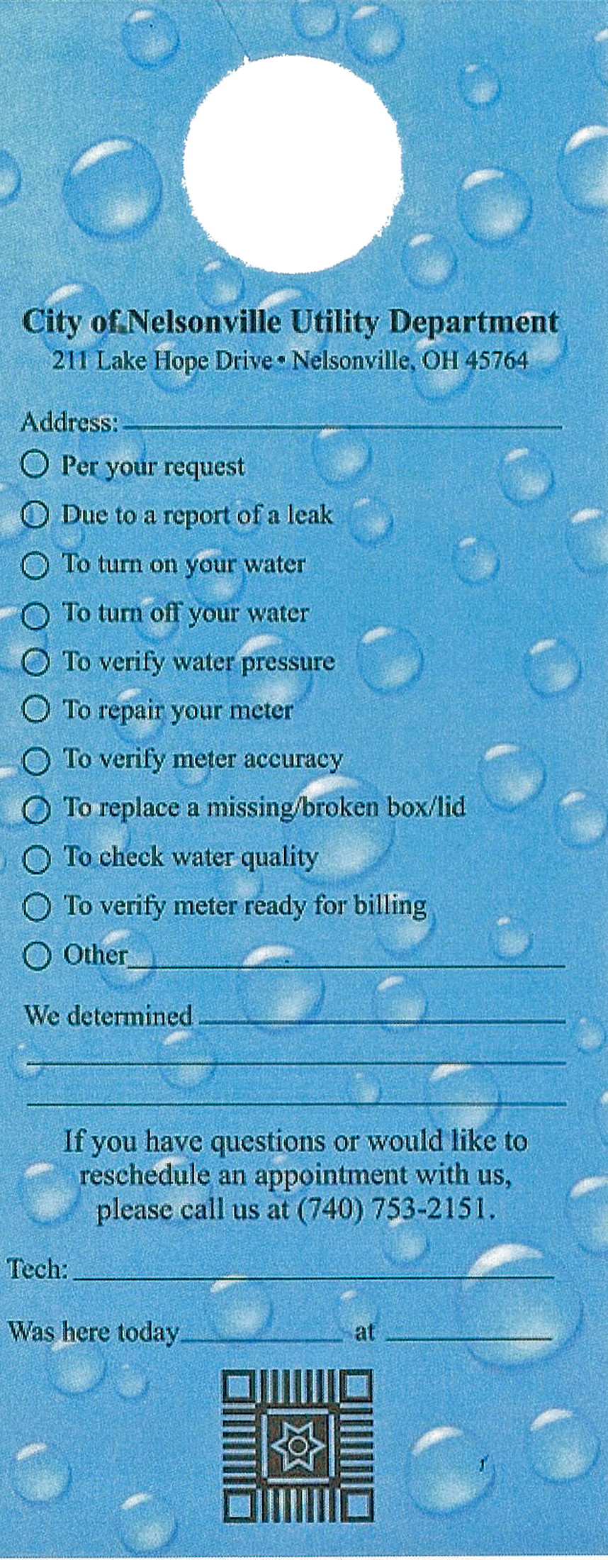
The Nelsonville Utilities Department has started a new service tag program. If you find a service tag on your door, it means that work has been performed at your meter. The service tag indicates the following information,
If you have any questions, please stop by the office or contact us by telephone, or Email.
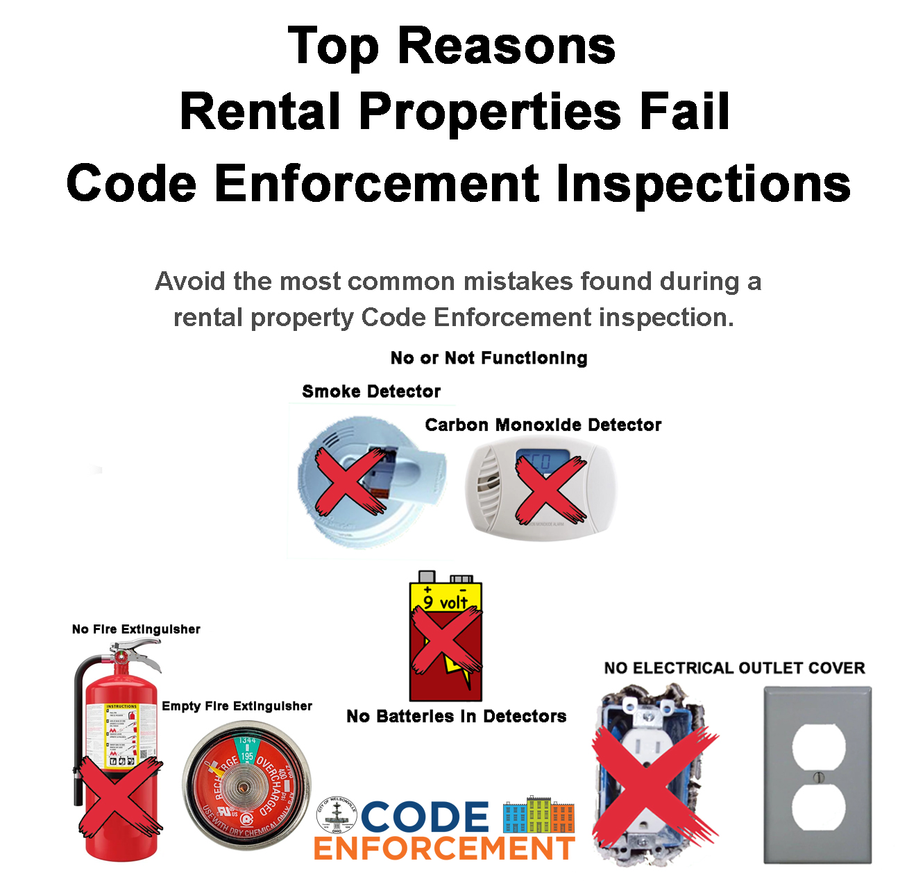
The City of Nelsonville Code Enforcement Office has been finding the same code violations as they are inspecting rental properties. The most common issue found inspecting rental properties are basic safety issues.
The most common issues are:
These issues are basic fire safety items, and the Code Office wants to make sure that the public knows that these items are required to be in all rental properties. We encourage rental property owners to reach out to our office if they think they have any issues of concern within their rental property.
Please contact Austin Kelley, Code Enforcement Officer, if you have any questions or concerns. (740 753-1314 or codeenforcement@cityofnelsonville.com

The Nelsonville City Council regular meeting scheduled for Monday, July 27, 2026, has been canceled. The next scheduled meeting is scheduled for Monday, August 10, 2026, at 7:00PM.
Nelsonville City Charter Section 4.05. Meetings. “Regular meetings shall be held at least twice in each calendar month, except that during the months of July and August the Council may dispense with one of its regular meetings.”

The Nelsonville Utilities Department has canceled the boil order for State Route 78 from Second Street to Duncan Drive (Buchtel Village Limits), Second Street, Third Street, Fourth Street, Wagner Street, Fork Street, Wilson Avenue, Emerson Drive, Stephenson Street, South Akron Avenue, Bank Street, Ohio Avenue, State Route 685 from State Route 78 to the Buchtel Village Limits, South Oakley Drive, North Oakley Drive, Duncan Drive, This also includes Buchtel Food Mart, 5339, 5534, 5532 and 5530 Happy Hollow Road, in the Village of Buchtel. The boil order was due to a water main break.
Thank you for your patience and understanding during this incident.
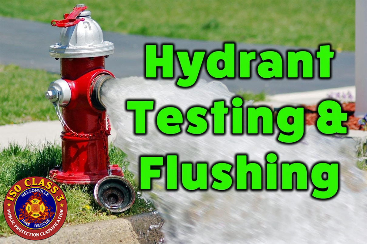
Nelsonville Division of Fire crew members will be performing required annual fire hydrant flow tests starting next week, July 27, 2026.
During fire hydrant testing we:
During fire hydrant flow testing you may see discolored water for a very short time. This is normal from sediment in the system moving and does not require boiling of water.
Why do we test hydrants?
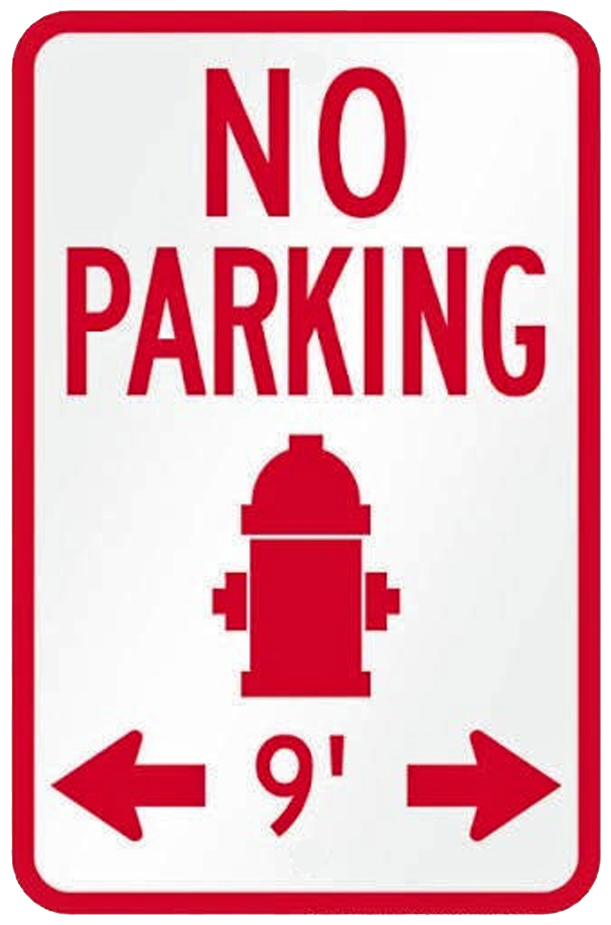
REMINDER, BLOCKING ACCESS TO A FIRE HYDRANT IS PROHIBITED BY LAW.
Ohio Fire Code 507.5.4 Obstruction.
Unobstructed access to fire hydrants shall be maintained at all times. The fire department shall not be deterred or hindered from gaining immediate access to fire protection equipment or fire hydrants. This means that vehicles, fences, landscaping, construction materials, dumpsters, or any other object that prevents immediate access to a fire hydrant are not permitted.
The City of Nelsonville has an overall 10 ft buffer area for fire hydrants, which comes to 9ft on each side. My office has been made aware that not all impacted curbs are painted red. This has been discussed with the appropriate department.
Thank you for your cooperation in maintaining a safer community.
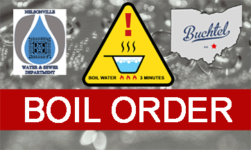
The Nelsonville Utilities Department has issued a boil order for State Route 78 from Second Street to Duncan Drive (Buchtel Village Limits), Second Street, Third Street, Fourth Street, Wagner Street, Fork Street, Wilson Avenue, Emerson Drive, Stephenson Street, South Akron Avenue, Bank Street, Ohio Avenue, State Route 685 from State Route 78 to the Buchtel Village Limits, South Oakley Drive, North Oakley Drive, Duncan Drive, This also includes Buchtel Food Mart, 5339, 5534, 5532 and 5530 Happy Hollow Road, in the Village of Buchtel. The Nelsonville City School is not included in this boil order.
This boil order is due to a water main break, The boil order is in effect until 12:00 PM Friday July 24, 2026. When a boil order is in effect, we ask all who are affected to boil their cooking and drinking water for three (3) minutes before being consumed.

The National Weather Service has issued a Severe Thunderstorm Watch for Athens County in effect from 1:10PM until 8:00PM, Tue, 7/21/2026.
Remember, a Severe Thunderstorm Watch means conditions are favorable for Severe Thunderstorms in and close to the watch area. People in these areas should be on the lookout for threatening weather conditions and listen for later statements and possible warnings. Severe Thunderstorms can and occasionally do produce Tornadoes.
Stay tuned to NOAA Weather Radio, local TV, radio or your cable television provider for later statements and possible warnings.
