Athens Co Excessive Heat Warning Tue, 6/14/22, 12PM until 8PM. Excessive Heat Watch extended until Thu, 6/16/22, 8PM

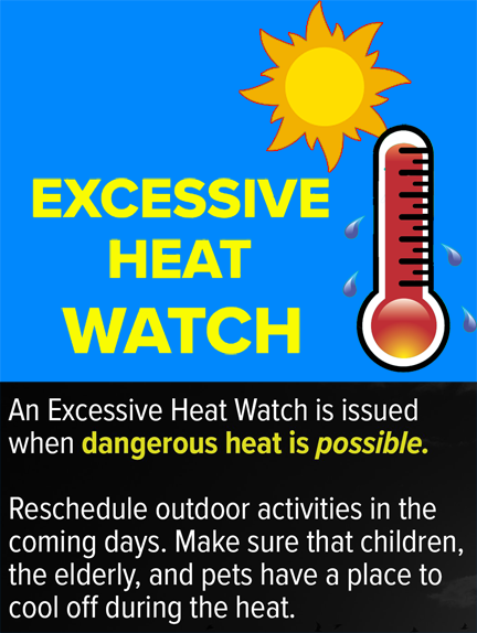
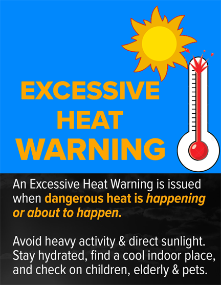
The National Weather Service has issued an Excessive Heat Warning for Athens County Tuesday, June 12, 2022, from 12:00PM until 8:00PM. The Excessive Heat Watch has been extended until Thursday, June 16, 2022 at 8:00PM.

WHAT…For the Excessive Heat Warning, dangerously hot conditions with heat index values up to 109 expected. For the Excessive Heat Watch, dangerously hot conditions with heat index values up to 107 possible.

WHERE…Portions of southeast Ohio, northeast Kentucky and central, southern and western West Virginia.

WHEN…For the Excessive Heat Warning, from noon today to 8 PM this evening. For the Excessive Heat Watch, from Wednesday morning through Thursday evening.

IMPACTS…Extreme heat and humidity will significantly increase the potential for heat related illnesses, particularly for those working or participating in outdoor activities.

PRECAUTIONARY/PREPAREDNESS ACTIONS…Drink plenty of fluids, stay in an air-conditioned room, stay out of the sun, and check up on relatives and neighbors. Young children and pets should never be left unattended in vehicles under any circumstances.

Take extra precautions if you work or spend time outside. When possible, reschedule strenuous activities to early morning or evening. Know the signs and symptoms of heat exhaustion and heat stroke. Wear lightweight and loose-fitting clothing when possible. To reduce risk during outdoor work, the Occupational Safety and Health Administration recommends scheduling frequent rest breaks in shaded or air-conditioned environments. Anyone overcome by heat should be moved to a cool and shaded location. Heat stroke is an emergency! Call 9-1-1.

Athens Co Severe Thunderstorm Watch in effect until 1AM, Tue, 6/14/22, watch for rapidly changing weather conditions

The National Weather Service has issued a Severe Thunderstorm Watch for Athens County until 1:00AM, Tuesday, June 14, 2022, watch for rapidly changing weather conditions.

Remember, a Severe Thunderstorm Watch means conditions are favorable for Sever Thunderstorms in and close to the watch area. Persons in these areas should be on the lookout for threatening weather conditions and listen for later statements and possible warnings. Severe Thunderstorms can and occasionally do produce Tornadoes.

Stay tuned to NOAA Weather Radio, local TV, radio or your cable television provider for later statements and possible warnings.

Athens Co Severe Thunderstorm Warning until Mon, 6/13/22, at 8:30PM, seek shelter if threatening weather approaches!

The National Weather Service has issued a Severe Thunderstorm Warning for Athens County until 830 PM, Monday, June 13, 2022. At 726 PM, severe thunderstorms were located along a line extending from near Groveport to near Piketon to 6 miles northeast of Vanceburg, moving east at 55 mph.

HAZARD…60 mph wind gusts and nickel size hail.

SOURCE…Radar indicated.

IMPACT…Expect damage to roofs, siding, and trees.

Locations impacted include… Athens, Nelsonville, Glouster, Albany.

PRECAUTIONARY/PREPAREDNESS ACTIONS… For your protection move to an interior room on the lowest floor of a building.

Damaging winds and continuous cloud to ground lightning is occurring with these storms. Move indoors immediately. Lightning is one of nature`s leading killers. Remember, if you can hear thunder, you are close enough to be struck by lightning.

Torrential rainfall is occurring with these storms, and may lead to flash flooding. Do not drive your vehicle through flooded roadways.

Athens Co Excessive Heat Watch from 12PM, Tue, 6/14/22 until 8PM, Thu, 6/16/22

The National Weather Service has issued an Excessive Heat Watch for Athens County from 12:00PM, Tuesday, June 6, 2022 until 8:00PM, Thursday, June 16, 2022

  • WHAT…Dangerously hot conditions with heat index values up to110 possible.
  • WHERE…Portions of southeast Ohio, northeast Kentucky and western and southwestern West Virginia.
  • WHEN…From 12:00PM, Tuesday, June 6, 2022 until 8:00PM, Thursday, June 16, 2022.
  • IMPACTS…Extreme heat and humidity will significantly increase the potential for heat related illnesses, particularly for sensitive populations and those working or participating in outdoor activities.

PRECAUTIONARY/PREPAREDNESS ACTIONS… Monitor the latest forecasts and warnings for updates on thissituation. Be prepared to drink plenty of fluids, stay in an air-conditioned room, stay out of the sun, and check up on relativesand neighbors.

Young children and pets should never be left unattended in vehicles under any circumstances. This is especially true during warm or hot weather when car interiors can reach lethal temperatures in a matter of minutes.

Nelsonville City Council regular meeting Mon, 6/13/22, 7PM at City Hall, the public is invited and encouraged to attend

The Nelsonville City Council will hold a regular Council meeting on Monday, June 13, 2022, at 7:00PM in Council Chambers at City Hall.

Citizens comments and business and organizational comments may be made in person or Emailed to nelsonvillecity@gmail.com by 1PM, Monday, June 13, 2022. The meeting may be streamed on the City of Nelsonville YouTube channel at https://tinyurl.com/bhv6bp4u. The public is invited and encouraged to attend.

Western Athens Co TORNADO WARNING until 8PM. Take shelter if threatened!

The National Weather Service has issued a Tornado Warning for West central Athens County until 800 PM.

At 725 PM, a severe thunderstorm capable of producing a tornado was located near Hocking Hills State Park, or 11 miles northwest of MacArthur, moving east at 50 mph.

• HAZARD…Tornado.

• SOURCE…Radar indicated rotation.

• IMPACT…Flying debris will be dangerous to those caught without shelter. Mobile homes will be damaged or destroyed. Damage to roofs, windows, and vehicles will occur. Tree damage is likely.

This dangerous storm will be near Lake Hope State Park around 745 PM. Nelsonville around 750 PM. Nelsonville and Buchtel around 755 PM.

Other locations impacted by this tornadic thunderstorm include Buchtel.

PRECAUTIONARY/PREPAREDNESS ACTIONS…

TAKE COVER NOW! Move to a basement or an interior room on the lowest floor of a sturdy building. Avoid windows. If you are outdoors, in a mobile home, or in a vehicle, move to the closest substantial shelter and protect yourself from flying debris.

Athens Co TORNADO WATCH until 10PM, Wed, 6/8/22, watch for rapidly changing weather conditions, be prepared to shelter

The National Weather Service has issued a TORNADO WATCH for Athens County in effect until 10:00 PM, Wednesday, June 8, 2022.

Remember, a tornado watch means conditions are favorable for tornadoes and severe thunderstorms in and close to the watch area. Persons in these areas should be on the lookout for threatening weather conditions and listen for later statements and possible warnings.

Stay tuned to NOAA weather radio, local TV, radio or your cable television provider for later statements and possible warnings.

Nelsonville Finance Committee meeting Tue, 06/7/22, 6:30PM at City Hall, the public is invited and encouraged to attend

The City of Nelsonville Finance Committee will hold a meeting on Tuesday, June 7, 2022, at 6:30PM at City Hall. The meeting is being held to discuss City finances.

Citizens comments may be made in person or Emailed to nelsonvillecity@gmail.com by 1PM, Tuesday, June 7, 2022. The meeting may be streamed on the City of Nelsonville YouTube channel https://tinyurl.com/bhv6bp4u. The public is invited and encouraged to attend.

Nelsonville Dog Park Board meeting Thu, 6/9/22, 6PM, at City Hall, the public is invited and encouraged to attend

The City of Nelsonville Finance Committee will hold a meeting on Tuesday, June 7, 2022, at 6:30PM at City Hall. The meeting is being held to discuss City finances.

Citizens comments may be made in person or Emailed to nelsonvillecity@gmail.com by 1PM, Tuesday, June 7, 2022. The meeting may be streamed on the City of Nelsonville YouTube channel https://tinyurl.com/bhv6bp4u. The public is invited and encouraged to attend.