
The Nelsonville City Council announces that they will hold a special council meeting on Wednesday, April 13, 2016 at 5:30pm in council chambers for the purpose of selecting a City Manager.

The Nelsonville City Council announces that they will hold a special council meeting on Wednesday, April 13, 2016 at 5:30pm in council chambers for the purpose of selecting a City Manager.

Are you interested in the weather? Do you want to learn more about thunderstorms? Do you want to help your community and the National Weather Service? Then you may want to attend a SKYWARN Spotter Training Class.
The effects of severe weather are felt every year by many Americans. To obtain critical weather information, NOAA’s National Weather Service (NWS), established SKYWARN with partner organizations. SKYWARN is a volunteer program with between 350,000 and 400,000 trained severe weather spotters. These volunteers help keep their local communities safe by providing timely and accurate reports of severe weather to the National Weather Service.
Although SKYWARN spotters provide essential information for all types of weather hazards, the main responsibility of a SKYWARN spotter is to identify and describe severe local storms. In the average year, 10,000 severe thunderstorms, 5,000 floods and more than 1,000 tornadoes occur across the United States. These events threatened lives and property.
SKYWARN storm spotters are part of the ranks of citizens who form the first line of defense against severe weather. There can be no finer reward than to know that their efforts have given communities the precious gift of time–seconds and minutes that can help save lives. Training is free and typically last about 2 hours. You’ll learn:
A SKYWARN Spotter training class is being held in Athens County, Ohio on Monday, May 2, 2016. The training will be held at the American Red Cross building located at 100 South May Avenue in Athens, Ohio and will begin at 6:00 PM. The training is free and open to the public, bring a friend.

RED FLAG WARNING IN EFFECT FOR ATHENS COUNTY UNTIL 8 PM WEDNESDAY, 4/6 FOR LOW RELATIVE HUMIDITY LEVELS COMBINED WITH GUSTY WINDS.
PRECAUTIONARY/PREPAREDNESS ACTIONS:
A RED FLAG WARNING MEANS THAT CRITICAL FIRE WEATHER CONDITIONS ARE EITHER OCCURRING NOW OR WILL SHORTLY. A COMBINATION OF STRONG WINDS, LOW RELATIVE HUMIDITY AND WARM TEMPERATURES CAN CONTRIBUTE TO EXTREME FIRE BEHAVIOR.
The Nelsonville City Council announces that they will hold a special meeting on Wednesday, April 6, 2016 at 5:00pm in council chambers for the purpose of holding an executive session to interview City Manager candidates.

THE NATIONAL WEATHER SERVICE HAS ISSUED A WIND ADVISORY IN EFFECT SATURDAY, 4/2 FROM 2 PM THIS AFTERNOON TO 11 PM EDT THIS EVENING.
WINDS – INCREASING WEST 20 TO 30 MPH THIS AFTERNOON WITH GUSTS 45 TO 50 MPH LATE THIS AFTERNOON AND EARLY EVENING. THE HIGHEST GUSTS WILL OCCUR BETWEEN 6 PM AND 9 PM AS A COLD FRONT PASSES. WINDS WILL BEGIN TO DIMINISH LATE TONIGHT.
IMPACTS – TREE LIMBS AND SOME WEAK TREES MAY FALL, CREATING SCATTERED POWER HITS OR OUTAGES. TRAVELING MAY BECOME DIFFICULT IN THE HIGHER GUSTS, ESPECIALLY FOR HIGH PROFILE VEHICLES.
PRECAUTIONARY/PREPAREDNESS ACTIONS: A WIND ADVISORY IS ISSUED WHEN WIND GUSTS 46 TO 57 MPH ARE EXPECTED. WINDS THIS STRONG CAN MAKE DRIVING DIFFICULT, ESPECIALLY FOR HIGH PROFILE VEHICLES. USE EXTRA CAUTION.

The Nelsonville City Council announces that there will be a joint meeting of the Planning & Development, Utility Committee and Planning Commission meeting on Thursday, April 7, 2016 at 7:00 pm in council chambers. The Purpose of the meeting will be to discuss ticketing process, as well as, rental housing inspections. The public is invited and encouraged to attend.
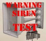
The outdoor emergency warning sirens in Nelsonville, The Plains and New Marshfield will be tested at 12 noon on Wednesday, April 6, 2016, with a one minute sounding of the sirens. Local residents are asked not to call local emergency agencies inquiring why the sirens are sounding.
The outdoor warning siren system is normally tested on the first Wednesday of every month at 12:00 p.m. The monthly test will be cancelled if severe weather is threatening. If severe weather cancels the test it will be postponed until the next month. There are three conditions that result in the warning sirens being activated in Athens County.
When the outdoor warning sirens are sounded for an emergency they will be activated for five minutes. When you hear the warning sirens you should do the following;
