
The Nelsonville City Council held a regular meeting Monday, January 27, 2025, at 7PM. The meeting was streamed on the City of Nelsonville YouTube channel at, https://tinyurl.com/bhv6bp4u.
The City of Nelsonville Street Committee held a meeting, Mon 1/27/25 Recording https://youtu.be/jR_yvTLKy-k
The City of Nelsonville Street Committee held a meeting on Monday, January 27, 2025, at 6:30PMat City Hall. The meeting was held to discuss,
- Winter storm parking issues.
- Summer street sweeper street cleaning.
The meeting was streamed on the City of Nelsonville YouTube channel at, https://tinyurl.com/bhv6bp4u.
Nelsonville Parks and Recreation Committee held a Meeting, Mon 1/27/25 Recording https://youtu.be/F5zHPjvR8Nc
The City of Nelsonville Parks and Recreation Committee held a meeting on Monday, January 27, 2025, at 6:15PM at City Hall. The meeting was held to discuss Polley Field lighting.
The meeting may be streamed on the City of Nelsonville YouTube channel https://tinyurl.com/bhv6bp4u.
Nelsonville City Council special meeting, Tue, 1/28/25, 7PM, at City Hall, he public is invited and encouraged to attend
The Nelsonville City Council will hold a special meeting on Tuesday, January 28, 2025, at 7:00 PM, at City Hall. The purpose of the meeting is to discuss and consider,
- Ordinance 04-25. AN ORDINANCE THAT CITY OF NELSONVILLE WILL PICK UP THE STATUTORILY REQUIRED CONTRIBUTION TO THE OHIO PUBLIC EMPLOYEES RETIREMENT SYSTEM FOR THE CITY ATTORNEY PURSUANT TO INTERNAL REVENUE CODE SECTION 414(h)(2) AND DECLARING AN EMERGENCY.
- Ordinance 05-25. AN ORDINANCE ADOPTING A MAP OF WARDS FOR THE CITY OF NELSONVILLE AND DECLARING AN EMERGENCY.
- Ordinance 06-25. AN ORDINANCE TO PLACE ON THE PRIMARY/SPECIAL ELECTION SCHEDULED FOR MAY 6, 2025 A PROPOSED AMENDMENT TO NELSONVILLE CITY CHARTER TO GIVE EFFECT TO THE EXPRESSED WILL OF THE VOTERS OF NELSONVILLE AND DECLARING AN EMERGENCY.
Citizens’ comments may be made in person or Emailed to councilclerk@cityofnelsonville.com by 1PM, Tuesday, January 28, 2025. The meeting may be streamed on the City of Nelsonville YouTube channel https://tinyurl.com/bhv6bp4u. The public is invited and encouraged to attend.
1/26/2025, 8:30AM – Athens Co snow emergency canceled, drive carefully some hazardous conditions may still exist in remote areas of the county

1/26/2025, 8:30AM – The snow emergency for Athens County has been canceled. Please drive carefully some hazardous road conditions may still exist in remote areas of the county.
Nelsonville Parks and Recreation Committee meeting Mon, 1/27/25, 6:30PM at City Hall, the public is invited and encouraged to attend

The City of Nelsonville Parks and Recreation Committee will hold a meeting on Monday, January 27, 2025, at 6:30PM at City Hall. The meeting is being held to discuss Polley Field lighting.
Citizens comments may be made in person or Emailed to councilclerk@cityofnelsonville.com by 1PM, Monday, January 27, 2025. The meeting may be streamed on the City of Nelsonville YouTube channel https://tinyurl.com/bhv6bp4u. The public is invited and encouraged to attend.
Nelsonville Street Committee meeting Mon, 1/27/25, 6:15PMat City Hall, the public is invited and encouraged to attend

The City of Nelsonville Street Committee will hold a meeting on Monday, January 27, 2025, at 6:15PMat City Hall. The meeting is being held to discuss,
- Winter storm parking issues.
- Summer street sweeper street cleaning.
Citizens comments may be made in person or Emailed to councilclerk@cityofnelsonville.com by 1PM, Monday, January 27, 2025. The meeting may be streamed on the City of Nelsonville YouTube channel https://tinyurl.com/bhv6bp4u. The public is invited and encouraged to attend.
Nelsonville Finance Committee meeting Mon, 1/27/25, 6PM at City Hall, the public is invited and encouraged to attend

The City of Nelsonville Finance Committee will hold a meeting on Monday, January 27, 2025, at 6:00 PM at City Hall. The meeting is being held to discuss the City finances.
Citizens comments may be made in person or Emailed to councilclerk@cityofnelsonville.com by 1PM, Monday, January 27, 2025. The meeting may be streamed on the City of Nelsonville YouTube channel https://tinyurl.com/bhv6bp4u. The public is invited and encouraged to attend.
1/23/2025, 11:30PM – Athens Co LEVEL 1 SNOW EMERGENCY. roadways hazardous, blowing, drifting snows, icy, drive very cautiously!

1/23/2025, 11:30PM – Athens County is under a LEVEL 1 SNOW EMERGENCY. Roadways are hazardous with blowing and drifting snow. Roads may also be icy. Motorists are urged to drive very cautiously.
Nelsonville reminds residential rental property owners, rental property fees were due 1/1/25, fees will be past due 2/2/25
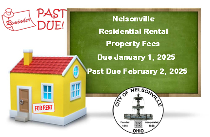
The City of Nelsonville would like to remind residential rental property owners, that rental property fees were due by January 1, 2025, and these fees will be considered past due on February 2, 2025, with an additional $100 penalty for each dwelling unit.
Nelsonville City Code §11.08.03, requires the owners of residential rental property to register each property with the City Manager. Rental property includes real property, one (1) or more dwellings used solely for residential purposes, a mobile home in a manufactured home park, a platted lot or parcel of land leased for the location of a mobile home, manufactured home, or industrialized unit.
To download a Rental Property Permit Application which contains the full code please go to – https://www.cityofnelsonville.com/code-office/permits-variances
Rental Property Permit Applications are also available in the code enforcement lobby at City Hall. Application fees can be paid in person or mailed to,
City of Nelsonville Code Enforcement
211 Lake Hope Drive
Nelsonville, OH 45764
For any questions, please call the Code Enforcement office at 740-753-1314.
