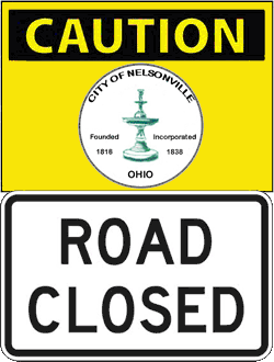
The City of Nelsonville announces that Watkins Street between Chestnut and Jefferson Streets and Chestnut Street between Grosvenor and Watkins Streets will be closed to traffic beginning Monday, July 8, 2013, for street construction until further notice.
Have a Safe and Happy 4th of July!!
FLASH FLOOD WATCH IN EFFECT FOR ATHENS CO FROM 12 NOON WED 7/3 THROUGH 12 NOON THU 7/4, WATCH FOR RISING WATER!
THE NATIONAL WEATHER SERVICE HAS ISSUED A FLASH FLOOD WATCH FOR ATHENS COUNTY FROM 12 NOON WEDNESDAY, 7/3 THROUGH 12 NOON THURSDAY, 7/4.
OCCASIONAL SHOWERS ARE LIKELY THIS AFTERNOON INTO INDEPENDENCE DAY. WITH THE GROUND WETTER THAN NORMAL, RAINS OF 1.5 TO 2 INCHES IN LESS THAN 6 HOURS COULD CAUSE THE AFFECTED SMALL STREAMS TO RISE QUICKLY ABOVE BANKFULL.
STRONG RISE MAY ALSO OCCUR ALONG THE AFFECTED HEADWATER RIVERS LATE TONIGHT AND ON THURSDAY.
PRECAUTIONARY/PREPAREDNESS ACTIONS:
A FLASH FLOOD WATCH MEANS THAT CONDITIONS MAY DEVELOP THAT LEAD TO FLASH FLOODING. FLASH FLOODING IS A DANGEROUS SITUATION.
IF YOU LIVE ALONG A FLOOD PRONE SMALL STREAM, PLUS COUNTY AND LOCAL OFFICIALS, CHECK WATER LEVELS FREQUENTLY IF REPETITIVE SHOWERS DO DEVELOP. EVEN LATE TONIGHT, THE POTENTIAL CONTINUES.
HAVE A PLAN, TO TAKE FAST ACTION, SHOULD WATER LEVELS RISE QUICKLY OR A FLASH FLOOD WARNINGS IS ISSUED.
Nelsonville’s Grover St closed beginning Sat, 7/6/13, at 7AM for 30 days to work on Orchard St water tower
Nelsonville Aquatic Center CLOSED, Mon, 7/1/13, due to a motor malfunction, tentatively scheduled to reopen Tue, 7/2/13
ATHENS CO IS UNDER A SEVERE THUNDER STORM WATCH UNTIL 8PM FRI, 6/28, WATCH FOR CHANGING WEATHER CONDITIONS
ATHENS CO IS UNDER A SEVERE THUNDER STORM WATCH UNTIL 8PM FRI, 6/28, WATCH FOR CHANGING WEATHER CONDITIONS.
REMEMBER, A SEVERE THUNDERSTORM WATCH MEANS CONDITIONS ARE FAVORABLE FOR SEVERE THUNDERSTORMS IN AND CLOSE TO THE WATCH AREA. PERSONS IN THESE AREAS SHOULD BE ON THE LOOKOUT FOR THREATENING WEATHER CONDITIONS AND LISTEN FOR LATER STATEMENTS AND POSSIBLE WARNINGS. SEVERE THUNDERSTORMS CAN AND OCCASIONALLY DO PRODUCE TORNADOES.
STAY TUNED TO NOAA WEATHER RADIO, LOCAL TV, RADIO OR YOUR CABLE TELEVISION PROVIDER FOR LATER STATEMENTS AND POSSIBLE WARNINGS.
Athens Co Emergency Warning Sirens in Nelsonville and The Plains will be tested Wed, 7/3 at 12 noon
The outdoor emergency warning sirens in Nelsonville and The Plains will be tested at 12 noon on Wednesday, July 3, 2013, with a one minute sounding of the sirens. This time change is so Athens County can participate in the statewide tornado drill. Local residents are asked not to call local emergency agencies inquiring why the sirens are sounding.
The outdoor warning siren system is normally tested on the first Wednesday of every month at 12:00 p.m. The monthly test will be cancelled if severe weather is threatening. If severe weather cancels the test it will be postponed until the next month. There are three conditions that result in the warning sirens being activated in Athens County.
1) Severe Weather
a) When the National Weather Service initiates a Tornado Warning for an area that includes areas of Athens County.
b) When the National Weather Service initiates a Severe Thunderstorm Warning (winds 58+ mph, large hail, severe lightening and heavy rains), for an area that includes areas of Athens County.
2) When there is an actual enemy or terrorist attack against the United States has been detected and is threatening areas of Athens County and protective action should be taken immediately.
3) When a public safety emergency occurs the sirens will be used to alert the public of emergencies such as hazardous materials incidents and civil disturbances.
When the outdoor warning sirens are sounded for an emergency they will be activated for five minutes. When you hear the warning sirens you should do the following;
DO NOT CALL 9-1-1 to ask why the sirens are sounding as this can overload the 9-1-1 emergency response system.
Remember, outdoor warning sirens are just that, out-door warning. The sirens are meant to be heard outside to signal you to go indoors and tune your radio or television station to the local Emergency Alert System (EAS) Station. As homes continue to become more energy efficient and sound proofing enhanced, outdoor warning sirens that once could be heard decades ago inside of a home can no longer be heard. That’s why other means of warning are in place.
Go immediately to a safe area in your home or building, if high winds, severe thunder and lightning are present.
If you are outside away from possible shelter, lie flat on the ground away from trees until the storm passes. If in a vehicle, get out and find a more substantial structure.
Carry a battery operated radio or NOAA all hazard alert radio to your safe area. You will know when the storm or emergency has passed and when it is clear to leave your safe area.
The Athens County SIRENS DO NOT identify specific types of storms or emergencies, therefore you should immediately seek shelter and tune to local television or radio for further information.

Nelsonville Farmers Market is open again Friday, 6/28 in front of the Hocking Valley Scenic Railway from 5PM-8PM
Nelsonville and Buchtel Boil Order has been CANCELED
The Nelsonville Water Department has canceled the boil order for Burr Oak Boulevard from Crihfield Drive to the Village of Buchtel, including the Village of Buchtel, Sylvania Ave, Carbon Hill Buchtel Road, Wood Lane Drive and Blair Court. Thank you for your cooperation and we apologize for any inconvenience this may have caused.
ATHENS CO FLASH FLOOD WATCH EXTENDED UNTIL 4PM THU 6/27, WATCH FOR CHANGING WEATHER CONDITIONS
THE FLASH FLOOD WATCH IS NOW IN EFFECT FOR ATHENS COUNTY HAS BEEN EXTENDED UNTIL 4 PM, THURSDAY, 6/27.
A SERIES OF UPPER LEVEL DISTURBANCES ALONG WITH ABUNDANT MOISTURE WILL BE CAPABLE TO PRODUCE STRONG THUNDERSTORMS THIS AFTERNOON THROUGH THURSDAY. A COLD FRONT WILL PASS THURSDAY NIGHT.
PERIODS OF VERY HEAVY RAINFALL AND REPETITIVE RAIN OVER THE SAME AREAS COULD PRODUCE SMALL STREAMS AND CREEKS TO BECOME OUT OF THEIR BANKS. IN ADDITION, FLOODING OF STREETS, LOW LYING AND POOR DRAINAGE AREAS COULD OCCUR.
PRECAUTIONARY/PREPAREDNESS ACTIONS:
A FLASH FLOOD WATCH MEANS THAT CONDITIONS MAY DEVELOP THAT LEAD TO FLASH FLOODING. FLASH FLOODING IS A VERY DANGEROUS SITUATION.
YOU SHOULD MONITOR LATER FORECASTS AND BE PREPARED TO TAKE ACTION SHOULD FLASH FLOOD WARNINGS BE ISSUED.