
Nelsonville City Council has a regular meeting on Monday, January 27th, starting at 7:00 pm. The meeting is in City Council Chambers at 211 Lake Hope Drive, Nelsonville, Ohio. The public is encouraged to attend.

Nelsonville City Council has a regular meeting on Monday, January 27th, starting at 7:00 pm. The meeting is in City Council Chambers at 211 Lake Hope Drive, Nelsonville, Ohio. The public is encouraged to attend.

WIND CHILL WATCH FOR ATHENS COUNTY FROM 7PM MONDAY, 1/27 THROUGH 11AM TUESDAY, 1/28.
HAZARD TYPES – DANGEROUS WIND CHILL VALUES
WIND CHILL READINGS – 20 TO 30 BELOW ZERO POSSIBLE
IMPACTS – FROST BITE AND HYPOTHERMIA ARE POSSIBLE IF ADEQUATE PRECAUTIONS ARE NOT TAKEN. PETS CAN ALSO SUFFER FROM WIND CHILLS THIS COLD
WINDS – WEST 5 TO 10 MPH WITH GUSTS UP TO 20 MPH
TEMPERATURES – ZERO TO 10 BELOW
PRECAUTIONARY/PREPAREDNESS ACTIONS:
A WIND CHILL WATCH MEANS THE THERE IS THE POTENTIAL FOR A COMBINATION OF VERY COLD AIR AND STRONG WINDS TO CREATE DANGEROUSLY LOW WIND CHILL VALUES.
STAY TUNED TO NOAA WEATHER RADIO OR YOUR FAVORITE SOURCE OF WEATHER INFORMATION FOR THE LATEST UPDATES.
ADDITIONAL DETAILS CAN ALSO BE FOUND AT WWW.WEATHER.GOV/RLX.

Athens County is now under a level 1 snow emergency. Roadways are hazardous with blowing and drifting snow. Roads may also be icy. Motorists are urged to drive very cautiously.

Everything You Wanted To Know About Snow Emergency Classifications, But Were Afraid To Ask.
Is there a Snow Emergency?
The snow emergency level for our county is reported by the same news organizations from which you’d learn about school delays and closures. You can also find the snow emergency level online at many places.
What is a Snow Emergency?
Local media might report something like: “Athens County is under a Level 2 Snow Emergency.” What does that mean for you?
The snow emergency level issued by county sheriffs in Ohio is meant to give citizens a sense of roadway conditions, and in some cases, to limit or restrict travel on roadways in the interest of safety. The authority to declare snow emergencies is placed on the county sheriff by Ohio law and, in order to clarify the definition, sheriffs of Ohio’s 88 counties adopted guidelines to be followed when closing highways due to severe weather.
Legal Background
A county sheriff may, pursuant to Ohio Revised Code sections 311.07 and 311.08, declare a snow emergency and temporarily close the state roads and municipal streets within his/her jurisdiction when such action is reasonably necessary for the preservation of the public peace. Ohio Attorney General Opinion 86-023 states that a Sheriff of a County may declare a snow emergency and temporarily close County and Township roads; Ohio Attorney General’s Opinion 97-015 (pdf), issued April 1, 1997, concluded that this authority includes state roads, county and township roads and municipal streets.
Any person who knowingly hampers or fails to obey a lawful order of the sheriff declaring a snow emergency and temporarily closing highways, roads and/or streets within his/her jurisdiction may be subject to criminal prosecution under Ohio Revised Code Section 2917.13, “Misconduct at an emergency” or other applicable law or ordinance.
Snow Emergency Classifications
LEVEL 1: Roadways are hazardous with blowing and drifting snow. Roads may also be icy. Motorists are urged to drive very cautiously.
LEVEL 2: Roadways are hazardous with blowing and drifting snow. Roads may also be very icy. Only those who feel it is necessary to drive should be out on the roads. Contact your employer to see if you should report to work. Motorists should use extreme caution.
LEVEL 3: All roadways are closed to non-emergency personnel. No one should be driving during these conditions unless it is absolutely necessary to travel or a personal emergency exists. All employees should contact their employer to see if they should report to work. Those traveling on the roads may subject themselves to arrest.
Drive Cautiously
Remember, it’s impossible to know the condition of every road in the county. These are only guidelines for the majority of roads. If, for example, a Level 1 Snow Emergency is in effect, there may be secondary roads that could be hazardous enough to be rated at level 2 or even possibly level 3.
If there is snow present, you should always assume that the road ahead is worse than the stretch of road you are currently on. In short, drive with extra regard for your speed and those around you especially on curves, hills, and the bridges which usually freeze well before the rest of the roadway. Also give yourself PLENTY of stopping distance especially on icy roads.

Athens County is under a level 2 snow emergency. Roadways are hazardous with blowing and drifting snow. Roads may also be very icy. Only those who feel it is necessary to drive should be out on the roads. Contact your employer to see if you should report to work. Motorists should use extreme caution.
Athens County is under a level 1 snow emergency. Roadways are hazardous with blowing and drifting snow. Roads may also be icy. Motorists are urged to drive very cautiously.
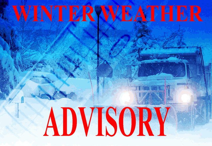
THE NATIONAL WEATHER SERVICE HAS ISSUED A WINTER WEATHER ADVISORY FOR SNOW, WHICH IS IN EFFECT FOR ATHENS COUNTY FROM 1 AM TO 7 PM SATURDAY, 1/25.
HAZARD TYPES – SNOW
SNOW ACCUMULATIONS – 2 TO 4 INCHES
TIMING – SNOWFALL FRIDAY NIGHT AND SATURDAY
IMPACTS – SNOWFALL WILL CAUSE UNTREATED ROADS TO BECOME SNOW COVERED, MAKING TRAVEL HAZARDOUS
WINDS – SOUTHWEST 5 TO 15 MPH WITH GUSTS UP TO 30 MPH ON SATURDAY
PRECAUTIONARY/PREPAREDNESS ACTIONS:
A WINTER WEATHER ADVISORY FOR SNOW MEANS THAT PERIODS OF SNOW WILL CAUSE PRIMARILY TRAVEL DIFFICULTIES. BE PREPARED FOR SNOW COVERED ROADS AND LIMITED VISIBILITIES AND USE CAUTION WHILE DRIVING.
PLEASE REPORT SNOW ACCUMULATIONS TO THE NATIONAL WEATHER SERVICE BY CALLING TOLL FREE 800-401-9535, WHEN YOU CAN DO SO SAFELY. THIS PHONE NUMBER IS TO BE USED FOR REPORTING PURPOSES ONLY.
YOU CAN ALSO REPORT WINTER WEATHER BY POSTING YOUR REPORT TO THE CHARLESTON WEST VIRGINIA NATIONAL WEATHER SERVICE FACEBOOK PAGE OR BY USING THE TWITTER HASHTAG, #NWSRLX.
STAY TUNED TO NOAA WEATHER RADIO OR YOUR FAVORITE SOURCE OF WEATHER INFORMATION FOR THE LATEST UPDATES.
 WIND CHILL ADVISORY FOR ATHENS COUNTY FROM 7PM THUR, 1/23 TO 10AM FRI, 1/24, TAKE PRECAUTIONS AGAINST THE COLD!
HAZARD TYPES – DANGEROUS WIND CHILL
WIND CHILL READINGS – AS LOW AS 18 BELOW
TIMING – THIS EVENING UNTIL 10 AM FRIDAY
IMPACTS – FROST BITE CAN LEAD TO HYPOTHERMIA OR DEATH IF PRECAUTIONS ARE NOT TAKEN
WINDS – WEST 10 TO 15 MPH WITH GUSTS UP TO 25 MPH
TEMPERATURES – 1 BELOW TO 13 ABOVE ZERO.
PRECAUTIONARY/PREPAREDNESS ACTIONS:
A WIND CHILL ADVISORY MEANS THAT VERY COLD AIR AND STRONG WINDS WILL COMBINE TO GENERATE LOW WIND CHILLS. THIS WILL RESULT IN FROST BITE AND LEAD TO HYPOTHERMIA IF PRECAUTIONS ARE NOT TAKEN. IF YOU MUST VENTURE OUTDOORS, MAKE SURE YOU WEAR A HAT AND GLOVES.
STAY TUNED TO NOAA WEATHER RADIO OR YOUR FAVORITE SOURCE OF WEATHER INFORMATION FOR THE LATEST UPDATES.
ADDITIONAL DETAILS CAN ALSO BE FOUND AT WWW.WEATHER.GOV/RLX.
THE NATIONAL WEATHER SERVICE HAS ISSUED A WIND CHILL ADVISORY FOR ATHENS COUNTY WHICH IS IN EFFECT FROM 1 AM TO 10 AM THURSDAY, 1/23.
HAZARD TYPES – DANGEROUS WIND CHILL
WIND CHILL READINGS – AS LOW AS 12 BELOW.
TIMING – OVERNIGHT TONIGHT UNTIL 10 AM THURSDAY
IMPACTS – FROST BITE CAN LEAD TO HYPOTHERMIA OR DEATH IF PRECAUTIONS ARE NOT TAKEN
WINDS – WEST 5 TO 15 MPH WITH GUSTS UP TO 25 MPH
TEMPERATURES – 4 TO 10 ABOVE
PRECAUTIONARY/PREPAREDNESS ACTIONS:
A WIND CHILL ADVISORY MEANS THAT VERY COLD AIR AND STRONG WINDS WILL COMBINE TO GENERATE LOW WIND CHILLS. THIS WILL RESULT IN FROST BITE AND LEAD TO HYPOTHERMIA IF PRECAUTIONS ARE NOT TAKEN. IF YOU MUST VENTURE OUTDOORS, MAKE SURE YOU WEAR A HAT AND GLOVES.
STAY TUNED TO NOAA WEATHER RADIO OR YOUR FAVORITE SOURCE OF WEATHER INFORMATION FOR THE LATEST UPDATES.
ADDITIONAL DETAILS CAN ALSO BE FOUND AT WWW.WEATHER.GOV/RLX.
THE NATIONAL WEATHER SERVICE HAS ISSUED A WIND CHILL ADVISORY FOR ATHENS COUNTY WHICH IS IN EFFECT FROM 7 PM TUESDAY, 1/21 UNTIL 12 NOON WEDNESDAY, 1/22.
HAZARD TYPES – LOWERING WIND CHILLS
TIMING – LOWERING WIND CHILLS TONIGHT
WINDS – NORTH 10 TO 20 MPH WITH GUSTS UP TO 30 MPH
WIND CHILL READINGS – AS LOW AS 13 BELOW TONIGHT.
PRECAUTIONARY/PREPAREDNESS ACTIONS:
A WIND CHILL ADVISORY MEANS THAT VERY COLD AIR AND STRONG WINDS WILL COMBINE TO GENERATE LOW WIND CHILLS. THIS WILL RESULT IN FROST BITE AND LEAD TO HYPOTHERMIA IF PRECAUTIONS ARE NOT TAKEN. IF YOU MUST VENTURE OUTDOORS, MAKE SURE YOU WEAR A HAT AND GLOVES.
PLEASE REPORT WEATHER OCCURANCES TO THE NATIONAL WEATHER SERVICE BY CALLING TOLL FREE 800-401-9535, WHEN YOU CAN DO SO SAFELY. THIS PHONE NUMBER IS TO BE USED FOR REPORTING PURPOSES ONLY.
YOU CAN ALSO REPORT WINTER WEATHER BY POSTING YOUR REPORT TO THE CHARLESTON WEST VIRGINIA NATIONAL WEATHER SERVICE FACEBOOK PAGE OR BY USING THE TWITTER HASHTAG, #NWSRLX.
STAY TUNED TO NOAA WEATHER RADIO OR YOUR FAVORITE SOURCE OF WEATHER INFORMATION FOR THE LATEST UPDATES.
ADDITIONAL DETAILS CAN ALSO BE FOUND AT WWW.WEATHER.GOV/RLX.

