
Athens County has CANCELED the snow emergency. Please Drive Carefully!

Athens County has CANCELED the snow emergency. Please Drive Carefully!

TEMPERATURES ACROSS THE AREA HAVE DROPPED BELOW FREEZING. TEMPERATURES WILL CONTINUE TO DROP INTO THE TEENS ACROSS SOUTHEAST OHIO. THESE TEMPERATURES WILL FREEZE ANY RUNOFF FROM MELTING SNOW. IN ADDITION, LIGHT SNOWFALL IS EXPECTED TO CONTINUE THROUGH TONIGHT.
THESE CONDITIONS ARE IDEAL FOR BLACK ICE FORMATION ON UNTREATED ROADS, SIDE WALKS AMONG OTHER SURFACES.
WATCH FOR ICY SPOTS AND EXERCISE CAUTION WHILE DRIVING OR WALKING THROUGH FRIDAY MORNING 2/7.
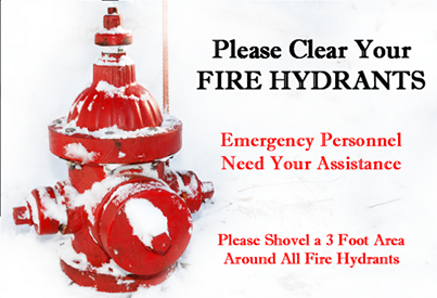
Please remember to clear snow from around fire hydrants and fire sprinkler connections. If there is a hydrant or sprinkler connection on your property, clearing the snow away keeps it visible and accessible to firefighters, saving valuable time when seconds count.

Athens County has been downgraded to a LEVEL 1 SNOW EMERGENCY. Roadways are hazardous with blowing and drifting snow. Roads may also be icy. Motorists are urged to drive very cautiously.

THE NATIONAL WEATHER SERVICE HAS ISSUED A WINTER STORM WARNING FOR FREEZING RAIN AND SLEET, WHICH IS IN EFFECT FOR ATHENS COUNTY UNTIL 10AM WEDNESDAY 2/5. THE WINTER WEATHER ADVISORY IS NO LONGER IN EFFECT.
HAZARD TYPES – SLEET AND FREEZING RAIN.
ICE ACCUMULATIONS – A QUARTER TO A HALF AN INCH.
SNOW AND SLEET ACCUMULATIONS – UP TO 2 INCHES.
TIMING – OVERNIGHT.
IMPACTS – HAZARDOUS TRAVEL CONDITIONS ARE POSSIBLE DUE TO SLEET AND ICE ACCUMULATIONS, ESPECIALLY ON UNTREATED ROADS.
WINDS – EAST 10 TO 20 MPH.
TEMPERATURES – IN THE UPPER 20S TO LOWER 30S.
PRECAUTIONARY/PREPAREDNESS ACTIONS:
A WINTER STORM WARNING MEANS SIGNIFICANT AMOUNTS OF SLEET AND ICE ARE EXPECTED OR OCCURRING. STRONG WINDS ARE ALSO POSSIBLE. THIS WILL MAKE TRAVEL VERY HAZARDOUS OR IMPOSSIBLE.
PLEASE REPORT SNOW, SLEET AND ICE ACCUMULATIONS TO THE NATIONAL WEATHER SERVICE BY CALLING TOLL FREE 800-401-9535, WHEN YOU CAN DO SO SAFELY. THIS PHONE NUMBER IS TO BE USED FOR REPORTING PURPOSES ONLY.
YOU CAN ALSO REPORT WINTER WEATHER BY POSTING YOUR REPORT TO THE CHARLESTON WEST VIRGINIA NATIONAL WEATHER SERVICE FACEBOOK PAGE OR BY USING THE TWITTER HASHTAG, #NWSRLX.
STAY TUNED TO NOAA WEATHER RADIO OR YOUR FAVORITE SOURCE OF WEATHER INFORMATION FOR THE LATEST UPDATES.
ADDITIONAL DETAILS CAN ALSO BE FOUND AT WWW.WEATHER.GOV/RLX.

Athens County is under a LEVEL 2 SNOW EMERGENCY. Roadways are hazardous with blowing and drifting snow. Roads may also be very icy. Only those who feel it is necessary to drive should be out on the roads. Contact your employer to see if you should report to work. Motorists should use extreme caution.
WINTER WEATHER ADVISORY IN EFFECT FOR ATHENS CO FROM 5PM TUE, 2/4 TO 10AM WED, 2/5.
HAZARD TYPES – SLEET AND FREEZING RAIN.
ICE ACCUMULATIONS – ONE TO TWO TENTHS OF AN INCH.
SNOW ACCUMULATIONS – UP TO 1 INCH.
TIMING – PRECIPITATION WILL BEGIN IN THE LATE THIS AFTERNOON AND EARLY EVENING.
IMPACTS – HAZARDOUS TRAVEL CONDITIONS ARE POSSIBLE DUE TO REDUCED VISIBILITIES AND SNOW, SLEET AND ICE ACCUMULATIONS, ESPECIALLY ON UNTREATED ROADS.
WINDS – NORTHEAST 5 TO 10 MPH WITH GUSTS UP TO 20 MPH.
TEMPERATURES – IN THE LOWER 30S.
PRECAUTIONARY/PREPAREDNESS ACTIONS:
A WINTER WEATHER ADVISORY MEANS THAT PERIODS OF SNOW, SLEET OR FREEZING RAIN WILL CAUSE TRAVEL DIFFICULTIES. BE PREPARED FOR SLIPPERY ROADS AND LIMITED VISIBILITIES AND USE CAUTION WHILE DRIVING.
PLEASE REPORT SNOW, SLEET, FREEZING RAIN ACCUMULATIONS TO THE NATIONAL WEATHER SERVICE BY CALLING TOLL FREE 800-401-9535, WHEN YOU CAN DO SO SAFELY. THIS PHONE NUMBER IS TO BE USED FOR REPORTING PURPOSES ONLY.
YOU CAN ALSO REPORT WINTER WEATHER BY POSTING YOUR REPORT TO THE CHARLESTON WEST VIRGINIA NATIONAL WEATHER SERVICE FACEBOOK PAGE. OR BY USING THE TWITTER HASHTAG, #NWSRLX.
STAY TUNED TO NOAA WEATHER RADIO OR YOUR FAVORITE SOURCE OF WEATHER INFORMATION FOR THE LATEST UPDATES.
ADDITIONAL DETAILS CAN ALSO BE FOUND AT WWW.WEATHER.GOV/RLX.
Athens County is under a LEVEL 1 SNOW EMERGENCY, roadways are hazardous with blowing and drifting snow. Roads may also be icy. Motorists are urged to drive very cautiously.

THE NATIONAL WEATHER SERVICE HAS ISSUED A FLOOD WATCH FOR ATHENS COUNTY FROM 8 PM TUESDAY, 2/4 THROUGH 12 NOON WEDNESDAY, 2/5.
THE GROUND IS SATURATED AT THE SURFACE AND FROZEN FURTHER DOWN. A STORM SYSTEM IS EXPECTED TO MOVE ACROSS THE REGION TUESDAY NIGHT THROUGH WEDNESDAY. THIS STORM HAS THE POSSIBILITY OF PRODUCING RAINFALL AMOUNTS BETWEEN 1.0 AND 1.5 INCHES, STARTING TUESDAY NIGHT AND CONTINUING INTO WEDNESDAY MORNING. RECENT SNOWS IN SOME AREAS COULD MELT AND ADD TO THE RUNOFF. THERE IS STILL SOME ICE ON THE STREAMS, CREEKS AND RIVERS IN THE HIGHEST ELEVATIONS. IF THIS RAIN IS REALIZED, SMALL STREAMS AND CREEKS COULD FLOOD FIRST LEADING TO STRONG RISES ON THE RIVERS.
PRECAUTIONARY/PREPAREDNESS ACTIONS:
A FLOOD WATCH MEANS THERE IS A POTENTIAL FOR FLOODING BASED ON CURRENT FORECASTS. YOU SHOULD MONITOR LATER FORECASTS AND BE ALERT FOR POSSIBLE FLOOD WARNINGS. THOSE LIVING IN AREAS PRONE TO FLOODING SHOULD BE PREPARED TO TAKE ACTION SHOULD FLOODING DEVELOP.
The outdoor emergency warning sirens in Nelsonville and The Plains will be tested at 12 noon on Wednesday, February 5, 2014, with a one minute sounding of the sirens. Local residents are asked not to call local emergency agencies inquiring why the sirens are sounding.
The outdoor warning siren system is normally tested on the first Wednesday of every month at 12:00 p.m. The monthly test will be cancelled if severe weather is threatening. If severe weather cancels the test it will be postponed until the next month. There are three conditions that result in the warning sirens being activated in Athens County.
1) Severe Weather
a) When the National Weather Service initiates a Tornado Warning for an area that includes areas of Athens County.
b) When the National Weather Service initiates a Severe Thunderstorm Warning (winds 58+ mph, large hail, severe lightening and heavy rains), for an area that includes areas of Athens County.
2) When there is an actual enemy or terrorist attack against the United States has been detected and is threatening areas of Athens County and protective action should be taken immediately.
3) When a public safety emergency occurs the sirens will be used to alert the public of emergencies such as hazardous materials incidents and civil disturbances.
When the outdoor warning sirens are sounded for an emergency they will be activated for five minutes. When you hear the warning sirens you should do the following;
DO NOT CALL 9-1-1 to ask why the sirens are sounding as this can overload the 9-1-1 emergency response system.
Remember, outdoor warning sirens are just that, out-door warning. The sirens are meant to be heard outside to signal you to go indoors and tune your radio or television station to the local Emergency Alert System (EAS) Station. As homes continue to become more energy efficient and sound proofing enhanced, outdoor warning sirens that once could be heard decades ago inside of a home can no longer be heard. That’s why other means of warning are in place.
Go immediately to a safe area in your home or building, if high winds, severe thunder and lightning are present.
If you are outside away from possible shelter, lie flat on the ground away from trees until the storm passes. If in a vehicle, get out and find a more substantial structure.
Carry a battery operated radio or NOAA all hazard alert radio to your safe area. You will know when the storm or emergency has passed and when it is clear to leave your safe area.
The Athens County SIRENS DO NOT identify specific types of storms or emergencies, therefore you should immediately seek shelter and tune to local television or radio for further information.

