ATHENS CO WINTER STORM WARNING FROM 1 PM WED, 3/4 TO 1 PM THU, 3/5, PREPARE FOR SEVERE WINTER WEATHER!

Winter storm warning

THE NATIONAL WEATHER SERVICE HAS ISSUED A WINTER STORM WARNING FOR HEAVY SNOW AND SLEET, WHICH IS IN EFFECT FOR ATHENS COUNTY FROM 1 PM WEDNESDAY, 3/4 TO 1 PM THURSDAY, 3/5. THE WINTER STORM WATCH IS NO LONGER IN EFFECT.

HAZARD TYPES – SNOW AND SLEET.

SNOW ACCUMULATIONS – 4 TO 8 INCHES.

TIMING – WEDNESDAY AFTERNOON AND NIGHT.

IMPACTS – UNTREATED ROADS AND SIDEWALKS COULD BECOME SNOW AND ICE COVERED. SNOW COULD CAUSE DOWNED TREE LIMBS AND POWER OUTAGES.

PRECAUTIONARY/PREPAREDNESS ACTIONS: A WINTER STORM WARNING FOR HEAVY SNOW MEANS SEVERE WINTER WEATHER CONDITIONS ARE EXPECTED OR OCCURRING. SIGNIFICANT AMOUNTS OF SNOW ARE FORECAST THAT WILL MAKE TRAVEL DANGEROUS. ONLY TRAVEL IN AN EMERGENCY. IF YOU MUST TRAVEL, KEEP AN EXTRA FLASHLIGHT, FOOD, AND WATER IN YOUR VEHICLE IN CASE OF AN EMERGENCY.

PLEASE REPORT SNOW ACCUMULATIONS TO THE NATIONAL WEATHER SERVICE BY CALLING TOLL FREE 1-800-401-9535, WHEN YOU CAN DO SO SAFELY. THIS PHONE NUMBER IS TO BE USED FOR REPORTING PURPOSES ONLY.

YOU CAN ALSO REPORT WINTER WEATHER BY POSTING YOUR REPORT TO THE CHARLESTON WEST VIRGINIA NATIONAL WEATHER SERVICE FACEBOOK PAGE OR BY USING THE TWITTER HASHTAG, NWSRLX.

STAY TUNED TO NOAA WEATHER RADIO OR YOUR FAVORITE SOURCE OF WEATHER INFORMATION FOR THE LATEST UPDATES.

ADDITIONAL DETAILS CAN ALSO BE FOUND AT WWW.WEATHER.GOV/RLX.
Take time know to prepare for thunderstorms – GET A KIT, MAKE A PLAN, BE INFORMED, GET INVOLVED!

thunderstorm safety

A thunderstorm is considered severe if it produces hail at least 1 inch in diameter or has wind gusts of at least 58 miles per hour. Every thunderstorm produces lightning, which kills more people each year than tornadoes or hurricanes. Heavy rain from thunderstorms can cause flash flooding, and high winds can damage homes and blow down trees and utility poles, causing widespread power outages.

Know the Difference

  • Severe Thunderstorm Watch – Severe thunderstorms are possible in and near the watch area. Stay informed and be ready to act if a severe thunderstorm warning is issued.
  • Severe Thunderstorm Warning – Severe weather has been reported by spotters or indicated by radar. Warnings indicate imminent danger to life and property.  Every year people are killed or seriously injured by severe thunderstorms despite advance warning. While some did not hear the warning, others heard the warning and did not pay attention to it. The information in this section, combined with timely watches and warnings about severe weather, may help save lives.

Every year people are killed or seriously injured by severe thunderstorms despite advance warning. While some did not hear the warning, others heard the warning and did not pay attention to it. The information in this section, combined with timely watches and warnings about severe weather, may help save lives.

Responding appropriately during a thunderstorm

  • Listen to local news or NOAA Weather Radio for emergency updates. Watch for signs of a storm, like darkening skies, lightning flashes or increasing wind.
  • Postpone outdoor activities if thunderstorms are likely to occur. Many people struck by lightning are not in the area where rain is occurring.
  • If a severe thunderstorm warning is issued, take shelter in a substantial building or in a vehicle with the windows closed. Get out of mobile homes that can blow over in high winds.
  • If you can hear thunder, you are close enough to be in danger from lightning. If thunder roars, go indoors! The National Weather Service recommends staying inside for at least 30 minutes after the last thunder clap.
  • Avoid electrical equipment and telephones. Use battery-powered TVs and radios instead.
  • Shutter windows and close outside doors securely. Keep away from windows.
  • Do not take a bath, shower or use plumbing.
  • If you are driving, try to safely exit the roadway and park. Stay in the vehicle and turn on the emergency flashers until the heavy rain ends. Avoid touching metal or other surfaces that conduct electricity in and outside the vehicle.

If you are outside and cannot reach a safe building, avoid high ground; water; tall, isolated trees; and metal objects such as fences or bleachers. Picnic shelters, dugouts and sheds are NOT safe.

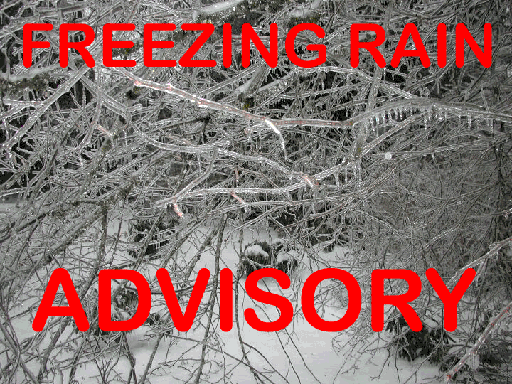
ATHENS CO FREEZING RAIN ADVISORY IN EFFECT FROM 7AM TO 1PM TUE 3/3, WATCH FOR CHANGING WEATHER CONDITIONS.

Freezing Rain Advisory

THE NATIONAL WEATHER SERVICE HAS ISSUED A FREEZING RAIN ADVISORY, WHICH IS IN EFFECT FROM 7 AM THIS MORNING TUESDAY 3/3 TO 1 PM THIS AFTERNOON.

HAZARD TYPES – FREEZING RAIN.

ICE ACCUMULATIONS – A FEW HUNDREDTHS OF AN INCH.

TIMING – THIS MORNING, PRIMARILY 8 AM TO 10 AM.

IMPACTS – SLICK SURFACES ESPECIALLY WHERE UNTREATED OR ELEVATED AND MAINLY IN HOLLOWS AND VALLEYS.

TEMPERATURES – IN THE UPPER 20S, RISING INTO THE LOW TO MID 30S BY NOON.

PRECAUTIONARY/PREPAREDNESS ACTIONS: A FREEZING RAIN ADVISORY MEANS THAT PERIODS OF FREEZING RAIN OR FREEZING DRIZZLE WILL CAUSE TRAVEL DIFFICULTIES. BE PREPARED FOR SLIPPERY ROADS. SLOW DOWN AND USE CAUTION WHILE DRIVING.

PLEASE REPORT ICE ACCUMULATIONS TO THE NATIONAL WEATHER SERVICE BY CALLING TOLL FREE 1-800-401-9535, WHEN YOU CAN DO SO SAFELY.  THIS PHONE NUMBER IS TO BE USED FOR REPORTING PURPOSES ONLY.

YOU CAN ALSO REPORT WINTER WEATHER BY POSTING YOUR REPORT TO THE CHARLESTON WEST VIRGINIA NATIONAL WEATHER SERVICE FACEBOOK PAGE OR BY USING THE TWITTER HASHTAG, #NWSRLX.

STAY TUNED TO NOAA WEATHER RADIO OR YOUR FAVORITE SOURCE OF WEATHER INFORMATION FOR THE LATEST UPDATES.

ADDITIONAL DETAILS CAN ALSO BE FOUND AT WWW.WEATHER.GOV/RLX.
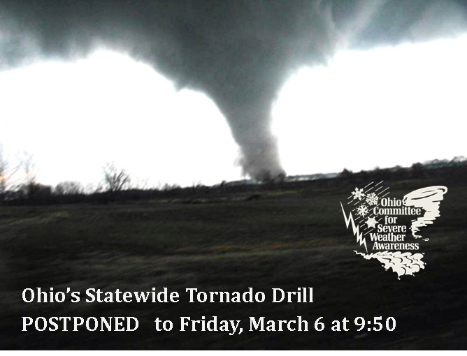
Ohio Statewide Tornado Drill Postponed Until, Friday, March 6 at 9:50 AM

Statewide Tornado Drill Postponed

Due to the National Weather Service Forecast of a Complex Winter Weather Pattern for the State of Ohio, the Wednesday, March 4th STATEWIDE TORNADO DRILL has been postponed until Friday, March 6th at 9:50 am.

Emergency Alert System test messages and sounding of outdoor warning sirens will be conducted during this time.

The National Weather Service forecasts a wintry mix of sleet, freezing rain, heavy rain and heavy snow. For current Ohio weather advisories, watches and warnings, visit the NWS site: http://alerts.weather.gov/cap/oh.php?x=1

Take time know to prepare for floods – GET A KIT, MAKE A PLAN, BE INFORMED, GET INVOLVED!

flooding_461637_7

Know what to do…

Before a Flood

  • Check with your local floodplain administrator to determine if you live in a flood-prone area. Lists of floodplain administrators are maintained by the Ohio Department of Natural Resources at: www.dnr.state.oh.us/Portals/7/floodpln/communitylist.pdf
  • Consider purchasing flood insurance. Flood insurance is available through the National Flood Insurance Program (NFIP) in any Ohio community that participates in the program.
  • Ensure that your home emergency plan includes an evacuation route, in case you must leave your home in a hurry. Practice your plan.
  • Learn more about flood safety, your flood risks, and flood insurance at: http://www.floodsmart.com.

During a Flood

  • If indoors, listen to a NOAA Weather Radio or local news station for the latest emergency information. If your area is advised to evacuate, do so immediately.
  • If outdoors, climb to higher ground and stay there. Avoid walking or driving through any floodwater.
  • Turn Around. Don’t Drown. Never drive through a flooded roadway. More than 70% of flood deaths occur when people purposely enter flood water. Do not attempt to cross flood water on foot or allow children to play in/near floodwaters.

During a Flood

  • Listen to local alerts and warning systems for emergency information.
  • Emergency workers are responding. Return home when authorities indicate it is safe.

Know the Terms

Flood: A condition that occurs when water overflows the natural or artificial confines of a stream or body of water, or accumulates by drainage or low-lying areas.

General River Flooding: A condition that follows heavy rain, snow melt or a combination. River flooding typically occurs slowly, allowing more time to take protective measures. Extreme flash flooding or a break up of an ice jam can produce more rapid river rises.

Urban and Small Stream Floods: Flooding occurs when heavy rain falls, resulting in flooding streets, underpasses or drainage ditches in urban areas, and creeks in rural areas. This flooding is dangerous if motorists drive through a flooded roadway or if children play near a storm drain or drainage ditch.

Flash Floods: Rapid and life-threatening floods resulting from heavy rains that occur in a short period of time.

Flood Watch: A flood watch is issued for the potential of rapid flooding. A flood watch may also be issues when the onset of flooding is much slower, usually greater than six hours.

Flash Flood Warning: A flash flood warning signifies a short duration of intense or rapid flooding of counties, communities, streams, or urban areas.

ATHENS CO FLOOD WATCH FROM 7PM, TUE, 3/3 TO 7AM THU, 3/5, WATCH FOR CHANGING WEATHER CONDITIONS!

Flood Watch

THE NATIONAL WEATHER SERVICE HAS ISSUED A FLOOD WATCH FOR ATHENS COUNTY FROM 7PM TUESDAY 3/3 UNTIL 7AM THURSDAY 3/5.

A STORM SYSTEM WILL BRING WIDESPREAD RAINS AND WARMER TEMPERATURES BY LATE TUESDAY NIGHT AND WEDNESDAY. ONE TO FOUR INCHES OF RAIN IS POSSIBLE THROUGH THE WATCH PERIOD. THIS RAIN COUPLED WITH SNOW MELT COULD CAUSE FLOODING OF STREAMS, CREEKS AND RIVERS THROUGHOUT THE REGION.

PERSONS ALONG ANY STREAMS, CREEKS AND RIVERS SHOULD MONITOR WATER LEVELS AND BE PREPARED TO TAKE ACTION SHOULD FLOODING DEVELOP.

PRECAUTIONARY/PREPAREDNESS ACTIONS: A FLOOD WATCH MEANS THERE IS A POTENTIAL FOR FLOODING BASED ON CURRENT FORECASTS. YOU SHOULD MONITOR LATER FORECASTS AND BE ALERT FOR POSSIBLE FLOOD WARNINGS. THOSE LIVING IN AREAS PRONE TO FLOODING SHOULD BE PREPARED TO TAKE ACTION SHOULD FLOODING DEVELOP.

Severe Weather Awareness Week March 1-7, 2015, Ohioans Are Encouraged to Prepare for Tornadoes, Floods and Thunderstorms

NSWPW 2015

The most common types of natural hazards affecting Ohio are floods, tornadoes, severe thunderstorms, and severe winter storms. Even large windstorms have been known to cause tremendous damage in Ohio, like the Derecho wind event on June 29, 2012. To assist in public awareness and to aid in the reduction of the impact severe weather can inflict on lives and property throughout Ohio, the Athens County Emergency Management Agency participates in statewide “Safety Awareness Weeks” during the spring and winter seasons.

“The ever changing weather of Southeast Ohio has demonstrated that we need to be prepared for all severe weather all the time,” said Fred Davis, Athens County Emergency Management Agency director. “The best defense when faced with floods or tornadoes or any severe weather event is preparedness: Be aware of current weather conditions. Have a disaster plan. Practice your plan. Make a supply kit. Stay informed.”

Governor John Kasich has proclaimed March 1-7 as Spring Severe Weather Awareness Week for Ohio. As part of a coordinated effort with the Ohio Committee for Severe Weather Awareness, Athens County will participate in a statewide tornado drill and test its Emergency Alert System on Wednesday, March 4th at 9:50 a.m. During this time, Ohio counties will sound their outdoor warning sirens. Schools, businesses and households are encouraged to practice their tornado drills and emergency plans.

For additional information on tornado safety and severe weather preparedness, visit www.weathersafety.ohio.gov.