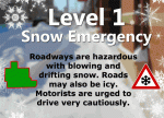
ATHENS COUNTY LEVEL 1 SNOW EMERGENCY
December 29, 2017, 21:05 hours
Athens County is under a LEVEL 1 SNOW EMERGENCY. Roadways are hazardous with blowing and drifting snow. Roads may also be icy. Motorists are urged to drive very cautiously.

ATHENS COUNTY LEVEL 1 SNOW EMERGENCY
December 29, 2017, 21:05 hours
Athens County is under a LEVEL 1 SNOW EMERGENCY. Roadways are hazardous with blowing and drifting snow. Roads may also be icy. Motorists are urged to drive very cautiously.
Athens County Winter Weather Advisory for snow in effect from 7PM, Friday, 12/29/17 to 10AM, Saturday, 12/30/17.
PRECAUTIONARY/PREPAREDNESS ACTIONS; A Winter Weather Advisory for snow means periods of snow will cause primarily travel difficulties. Be prepared for snow covered roads and limited visibilities, and use caution while driving. The latest road conditions for the state you are calling from can be obtained by calling 5-1-1.

ATHENS COUNTY SNOW EMERGENCY CANCELED
December 27, 2017, 08:00 hours
The snow emergency for Athens County has been canceled. Please drive carefully some hazardous road conditions may still exist in remote areas of the county.
ATHENS COUNTY LEVEL 1 SNOW EMERGENCY
December 27, 2017, 00:10 hours
Athens County is under a LEVEL 1 SNOW EMERGENCY. Roadways are hazardous with blowing and drifting snow. Roads may also be icy. Motorists are urged to drive very cautiously.
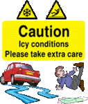
Slippery Road Conditions Throughout the Area! Rain yesterday evening, combined with scattered snow showers this morning and freezing temperatures, have resulted in slippery roads and hazardous driving conditions. Drivers are urged to use caution on untreated area roads, bridges and overpasses.
December 13, 2017, 13:10 hours
ATHENS COUNTY SNOW EMERGENCY CANCELED
The snow emergency for Athens County has been canceled. Please drive carefully some hazardous road conditions may still exist in remote areas of the county.
ATHENS COUNTY LEVEL 1 SNOW EMERGENCY
December 12, 2017, 20:40 hours
Athens County is under a LEVEL 1 SNOW EMERGENCY. Roadways are hazardous with blowing and drifting snow. Roads may also be icy. Motorists are urged to drive very cautiously.
Athens County road conditions have become hazardous due to changing weather conditions. Roadways are icy and slippery. Numerous traffic accidents have been reported. Travel only if necessary and use caution!!
After an initial round of light showers of rain, snow and sleet mixed, moderate to heavy snow showers will move across the area this evening as colder air invades. The heaviest snow showers will be capable of producing a quick half of an inch or so of snow, with wind gusts up to 25 mph as they pass.
With the colder air and fall of darkness, temperatures will drop to and below freezing, so roads could become snow covered, and icy spots could develop. Rapidly changing visibilities over short distances are likely, with visibility in some locations briefly falling below half of a mile. Use caution if traveling this evening, especially since this is the first accumulating snow of the season.

The National Weather Service has issued a Flash Flood Warning for Western Athens County until 10:15 AM.
At 4:15 AM, Doppler radar and automated rain gauges indicated thunderstorms producing heavy rain across the warned area. 2 to 3.5 inches of rain have already fallen. Flash flooding is expected to begin shortly.
Some locations that will experience flooding include Nelsonville, Albany, Buchtel, Carbondale, New Marshfield, Shade and The Plains.
PRECAUTIONARY/PREPAREDNESS ACTIONS; Be especially cautious at night when it is harder to recognize the dangers of flooding.
Please report Severe Weather to the National Weather Service by calling toll free, 800 401 9535, when you can do so safely.
You may also report severe weather by posting your report to the Charleston West Virginia National Weather Service Facebook Page, or by using the Twitter Hashtag, NWSRLX.

