ATHENS CO WINTER STORM WARNING 12 MIDNIGHT TO 12 NOON TUE 1/6, 3 TO 5 INCHES OF SNOW EXPECTED OVERNIGHT

Winter storm warning

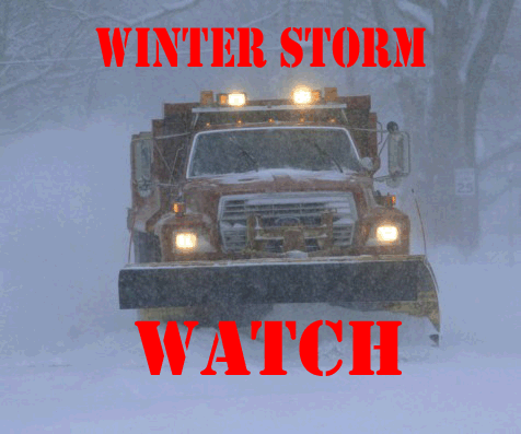
THE NATIONAL WEATHER SERVICE HAS ISSUED A WINTER STORM WARNING FOR HEAVY SNOW FOR ATHENS COUNTY, WHICH IS IN EFFECT FROM MIDNIGHT TONIGHT TO NOON TUESDAY 1/6. THE WINTER STORM WATCH IS NO LONGER IN EFFECT.

HAZARD TYPES – SNOW.

SNOW ACCUMULATIONS – 3 TO 5 INCHES.

TIMING – LATE TONIGHT THROUGH TUESDAY MORNING, WITH THE HEAVIEST SNOWFALL EXPECTED TO OCCUR OVERNIGHT THROUGH DAWN.

IMPACTS – HAZARDOUS TRAVEL CONDITIONS DUE TO SNOW COVERED ROADS AND LIMITED VISIBILITIES. THE MORNING COMMUTE TUESDAY WILL BE IMPACTED.

WINDS – SOUTH 5 MPH OR LESS.

TEMPERATURES – AROUND 20.

PRECAUTIONARY/PREPAREDNESS ACTIONS:
A WINTER STORM WARNING FOR HEAVY SNOW MEANS SEVERE WINTER WEATHER CONDITIONS ARE EXPECTED OR OCCURRING. SIGNIFICANT AMOUNTS OF SNOW ARE FORECAST THAT WILL MAKE TRAVEL DANGEROUS. ONLY TRAVEL IN AN EMERGENCY. IF YOU MUST TRAVEL, KEEP AN EXTRA FLASHLIGHT, FOOD AND WATER IN YOUR VEHICLE IN CASE OF AN EMERGENCY.

PLEASE REPORT SNOW ACCUMULATIONS TO THE NATIONAL WEATHER SERVICE BY CALLING TOLL FREE 1-800-401-9535, WHEN YOU CAN DO SO SAFELY. THIS PHONE NUMBER IS TO BE USED FOR REPORTING PURPOSES ONLY.

YOU CAN ALSO REPORT WINTER WEATHER BY POSTING YOUR REPORT TO THE CHARLESTON WEST VIRGINIA NATIONAL WEATHER SERVICE FACEBOOK PAGE OR BY USING THE TWITTER HASHTAG, #NWSRLX.

STAY TUNED TO NOAA WEATHER RADIO OR YOUR FAVORITE SOURCE OF WEATHER INFORMATION FOR THE LATEST UPDATES.

ADDITIONAL DETAILS CAN ALSO BE FOUND AT WWW.WEATHER.GOV/RLX.

ATHENS CO WINTER STORM WATCH IN EFFECT 12 MIDNIGHT 1/6 THROUGH TUE 1/6 AT 12 NOON, 3 TO 5 INCHES OF SNOW POSSIBLE

Winter storm watch

THE NATIONAL WEATHER SERVICE HAS ISSUED A WINTER STORM WATCH FOR ATHENS COUNTY, WHICH IS IN EFFECT FROM 12 MIDNIGHT 1/6 THROUGH 12 NOON TUESDAY 1/6.

HAZARD TYPES – SNOW.

SNOW ACCUMULATIONS – 3 TO 5 INCHES.

TIMING – LATE TONIGHT THROUGH TUESDAY MORNING, WITH THE HEAVIEST SNOWFALL EXPECTED TO OCCUR OVERNIGHT THROUGH DAWN.

IMPACTS – HAZARDOUS TRAVEL CONDITIONS DUE TO SNOW COVERED ROADS AND LIMITED VISIBILITIES. THE MORNING COMMUTE TUESDAY WILL BE IMPACTED.

WINDS – SOUTHWEST 5 MPH OR LESS.

TEMPERATURES – IN THE UPPER TEENS TO LOWER 20S.

PRECAUTIONARY/PREPAREDNESS ACTIONS: A WINTER STORM WATCH MEANS THERE IS A POTENTIAL FOR SIGNIFICANT SNOW, SLEET OR ICE ACCUMULATIONS THAT MAY IMPACT TRAVEL.  CONTINUE TO MONITOR THE LATEST FORECASTS.

Athens County Emergency Warning Sirens will be tested January 7th

Siren Test

The outdoor emergency warning sirens in Nelsonville, The Plains and New Marshfield will be tested at 12 noon on Wednesday, January 7, 2015, with a one minute sounding of the sirens. Local residents are asked not to call local emergency agencies inquiring why the sirens are sounding.

The outdoor warning siren system is normally tested on the first Wednesday of every month at 12:00 p.m. The monthly test will be cancelled if severe weather is threatening. If severe weather cancels the test it will be postponed until the next month. There are three conditions that result in the warning sirens being activated in Athens County.

  1. Severe Weather
    1. When the National Weather Service initiates a Tornado Warning for an area that includes areas of Athens County.
    2. When the National Weather Service initiates a Severe Thunderstorm Warning (winds 58+ mph, large hail, severe lightening and heavy rains), for an area that includes areas of Athens County.
  2.  When there is an actual enemy or terrorist attack against the United States has been detected and is threatening areas of Athens County and protective action should be taken immediately.
  3. When a public safety emergency occurs the sirens will be used to alert the public of emergencies such as hazardous materials incidents and civil disturbances.

When the outdoor warning sirens are sounded for an emergency they will be activated for five minutes. When you hear the warning sirens you should do the following;

  1.  DO NOT CALL 9-1-1 to ask why the sirens are sounding as this can overload the 9-1-1 emergency response system.
  2. Remember, outdoor warning sirens are just that, out-door warning. The sirens are meant to be heard outside to signal you to go indoors and tune your radio or television station to the local Emergency Alert System (EAS) Station. As homes continue to become more energy efficient and sound proofing enhanced, outdoor warning sirens that once could be heard decades ago inside of a home can no longer be heard. That’s why other means of warning are in place.
  3. Go immediately to a safe area in your home or building, if high winds, severe thunder and lightning are present.
  4. If you are outside away from possible shelter, lie flat on the ground away from trees until the storm passes. If in a vehicle, get out and find a more substantial structure.
  5.  Carry a battery operated radio or NOAA all hazard alert radio to your safe area. You will know when the storm or emergency has passed and when it is clear to leave your safe area.
  6. The Athens County SIRENS DO NOT identify specific types of storms or emergencies, therefore you should immediately seek shelter and tune to local television or radio for further information.