
Athens County is under a level 1 snow emergency. Roadways are hazardous with blowing and drifting snow. Roads may also be icy. Motorists are urged to drive very cautiously.

Athens County is under a level 1 snow emergency. Roadways are hazardous with blowing and drifting snow. Roads may also be icy. Motorists are urged to drive very cautiously.

THE NATIONAL WEATHER SERVICE HAS ISSUED A WINTER WEATHER ADVISORY FOR SNOW WHICH IS IN EFFECT FOR ATHENS FROM 7 AM FRIDAY 12/6 TO 1 AM SATURDAY 12/7.
HAZARD TYPES – SNOW
SNOW ACCUMULATIONS – 1 TO 3 INCHES
TIMING – THE BULK OF THE SNOW WILL OCCUR FROM FRIDAY AFTERNOON AND NIGHT
IMPACTS – ICY SPOTS ON ROADS AND SIDEWALKS, ESPECIALLY ON ELEVATED SURFACES SUCH AS ON BRIDGES AND OVERPASSES
WINDS – NORTH 10 TO 15 MPH WITH GUSTS UP TO 20 MPH
TEMPERATURES – IN THE LOWER 30S.
PRECAUTIONARY/PREPAREDNESS ACTIONS;
A WINTER WEATHER ADVISORY FOR SNOW MEANS THAT PERIODS OF SNOW WILL CAUSE PRIMARILY TRAVEL DIFFICULTIES. BE PREPARED FOR SNOW COVERED ROADS AND LIMITED VISIBILITIES AND USE CAUTION WHILE DRIVING.
PLEASE REPORT SNOW ACCUMULATIONS TO THE NATIONAL WEATHER SERVICE BY CALLING TOLL FREE 800-401-9535, WHEN YOU CAN DO SO SAFELY.
THIS PHONE NUMBER IS TO BE USED FOR REPORTING PURPOSES ONLY.
YOU CAN ALSO REPORT WINTER WEATHER BY POSTING YOUR REPORT TO THE CHARLESTON WEST VIRGINIA NATIONAL WEATHER SERVICE FACEBOOK PAGE OR BY USING THE TWITTER HASHTAG #NWSRLX.
STAY TUNED TO NOAA WEATHER RADIO OR YOUR FAVORITE SOURCE OF WEATHER INFORMATION FOR THE LATEST UPDATES.
ADDITIONAL DETAILS CAN ALSO BE FOUND AT WWW.WEATHER.GOV/RLX.
The National Weather Service is predicting high amounts of precipitation through mid-day Saturday and then again beginning Sunday into Monday. Various parts of the tri-state and southern Ohio will be affected by flooding rains (worse case excess of 5 inches of rain), perhaps snow, sleet or even ice. The mountainous areas will likely be frozen precipitation for all of you travelers. Impacts could include small stream, urban and river flooding. Ice and sleet accumulations and snow in any given area.

The Nelsonville Police Department announces that there will be rolling street closures on Saturday, December 7, 2013, beginning at 8:00AM continuing through 11:30am for the Nelsonville Christmas Parade. The Public Square will be closed to all traffic beginning at 6:00AM through 12:00 NOON. All vehicles must be removed from the Public Square before 6:00AM Saturday morning
Parade line up begins at 8:00AM on Fayette Street between Jefferson and Rocky Boot Way. The parade begins at Rocky Boot Way continuing North on Rocky Boot Way, around the Public Square, West on Columbus Street to first alley past Cable Alley from W. Columbus to W. Washington Street, East on W. Washington Street ending at Fort Street. . Residents and visitors are urged to use caution while in the downtown area.

THE NATIONAL WEATHER SERVICE HAS ISSUED A FLOOD WATCH FOR SOUTHEAST OHIO INCLUDING ATHENS COUNTY FROM 7PM THURSDAY 12/5 THROUGH 7AM SATURDAY 12/7.
A FRONTAL SYSTEM WILL MOVE OVER THE REGION DURING THE DAY ON THURSDAY AND STALL. WARM MOIST AIR AHEAD OF THIS SYSTEM, COUPLED WITH SEVERAL WAVES OF LOW PRESSURE RIDING UP AND ALONG THE FRONTAL BOUNDARY WILL CAUSE PROLONG PERIODS OF RAIN, SOME OF WHICH COULD BE HEAVY. RAIN SHOULD DIMINISH SATURDAY MORNING.
RAIN AMOUNTS ARE EXPECTED TO BE BETWEEN 2 AND 3 INCHES OVER MUCH OF THE WATCH AREA.
WITH THESE RAIN AMOUNTS, SMALL STREAMS AND CREEKS COULD HAVE THE POTENTIAL TO FLOOD WHICH IN TURN COULD CAUSE SIGNIFICANT RISES ON RIVERS. THIS WATCH INCLUDES THE HOCKING RIVER BASIN.
PRECAUTIONARY/PREPAREDNESS ACTIONS;
A FLOOD WATCH MEANS THERE IS A POTENTIAL FOR FLOODING BASED ON CURRENT FORECASTS. YOU SHOULD MONITOR LATER FORECASTS AND BE ALERT FOR POSSIBLE FLOOD WARNINGS. THOSE LIVING ALONG FLOOD PRONE CREEKS AND RIVERS SHOULD BE PREPARED TO TAKE ACTION SHOULD FLOODING DEVELOP.

The Nelsonville Volunteer Firefighters will be holding their annual Breakfast Buffet on Saturday, December 7, 2013. The breakfast will be held at the Nelsonville Elks Lodge located on Hocking Street, in Nelsonville. Breakfast will be served from 7:00 a.m. until 12:00 noon. The price for breakfast is $5.00 for children 12 and under and $7.00 for adults.
This year’s menu will include;
Sausage Gravy & Biscuits
Pancakes
French toast
Link Sausage
Bacon
Scrambled Eggs
Hash Brown Potatoes
Cereal
Mixed Fruit
Beverages
The breakfast is being held in conjunction with the North Pole Nelsonville Christmas celebration. The public is encouraged to come out and eat a good breakfast before enjoying their day long activities in Nelsonville.
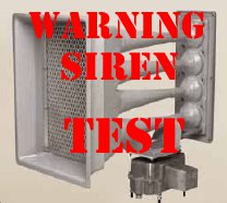
The outdoor emergency warning sirens in Nelsonville and The Plains will be tested at 12 noon on Wednesday, December 4, 2013, with a one minute sounding of the sirens. Local residents are asked not to call local emergency agencies inquiring why the sirens are sounding.
The outdoor warning siren system is normally tested on the first Wednesday of every month at 12:00 p.m. The monthly test will be cancelled if severe weather is threatening. If severe weather cancels the test it will be postponed until the next month. There are three conditions that result in the warning sirens being activated in Athens County.
1) Severe Weather
a) When the National Weather Service initiates a Tornado Warning for an area that includes areas of Athens County.
b) When the National Weather Service initiates a Severe Thunderstorm Warning (winds 58+ mph, large hail, severe lightening and heavy rains), for an area that includes areas of Athens County.
2) When there is an actual enemy or terrorist attack against the United States has been detected and is threatening areas of Athens County and protective action should be taken immediately.
3) When a public safety emergency occurs the sirens will be used to alert the public of emergencies such as hazardous materials incidents and civil disturbances.
When the outdoor warning sirens are sounded for an emergency they will be activated for five minutes. When you hear the warning sirens you should do the following;
DO NOT CALL 9-1-1 to ask why the sirens are sounding as this can overload the 9-1-1 emergency response system.
Remember, outdoor warning sirens are just that, out-door warning. The sirens are meant to be heard outside to signal you to go indoors and tune your radio or television station to the local Emergency Alert System (EAS) Station. As homes continue to become more energy efficient and sound proofing enhanced, outdoor warning sirens that once could be heard decades ago inside of a home can no longer be heard. That’s why other means of warning are in place.
Go immediately to a safe area in your home or building, if high winds, severe thunder and lightning are present.
If you are outside away from possible shelter, lie flat on the ground away from trees until the storm passes. If in a vehicle, get out and find a more substantial structure.
Carry a battery operated radio or NOAA all hazard alert radio to your safe area. You will know when the storm or emergency has passed and when it is clear to leave your safe area.
The Athens County SIRENS DO NOT identify specific types of storms or emergencies, therefore you should immediately seek shelter and tune to local television or radio for further information.

You need a personal safety and security plan to keep criminals at bay and you from seeing red.
This year many shoppers will be out early to find those big bargains on Black Friday or online for Cyber Monday, but the criminals will be out too. Here are 10 great tips to help you shop safely while getting those great holiday bargains throughout the shopping season.
1.Do not buy more than you can carry. Plan ahead by taking a friend with you or ask a store employee to help you carry your packages to the car.
2.Shop online with companies you know and trust. Check a company’s background if you are not familiar with it. Remember, if it sounds too good to be true, it usually is.
3.Save all receipts. Print and save all confirmations from your online purchases. Start a file folder to keep all receipts together and to help you verify credit card or bank statements as they come in.
4.Consider alternate options to pay for your merchandise, such as onetime or multiuse disposable credit cards or money orders, at online stores and auction sites.
5.Wait until asked before taking out your credit card or checkbook. An enterprising thief would love to shoulder surf to get your account information.
6.Deter pickpockets. Carry your purse close to your body or your wallet inside a coat or front trouser pocket.
7.Have your keys in hand when approaching your vehicle. Check the back seat and around the car before getting in.
8.Do not leave packages visible in your car windows. Lock them in the trunk or, if possible, take them directly home.
9.Tell a security guard or store employee if you see an unattended bag or package. The same applies if you are using mass transit.
10.If you are shopping with children, make a plan in case you get separated. Select a central meeting place and make sure they know they can ask mall personnel or store security employees if they need help.

The City of Nelsonville announces that all city offices will be CLOSED on Thursday, November 28 and Friday, November 29, in observance of the Thanksgiving Holiday. The City of Nelsonville wishes everyone a happy Thanksgiving and remember to drive safely if you are traveling.
WINTER WEATHER ADVISORY IN EFFECT FOR ATHENS COUNTY FROM 6 PM TUESDAY, November 26th TO 1 PM WEDNESDAY, NOVEMBER 27TH.
HAZARD TYPES – SNOW
SNOW ACCUMULATIONS – 2 TO 4 INCHES
TIMING – MAINLY LATER TONIGHT AND WEDNESDAY
WINDS – NORTHWEST 5 TO 15 MPH WITH GUSTS UP TO 25 MPH
TEMPERATURES – AROUND 30
